Description

Le lézard filtre le meilleur de la photographie sur internet ! Suivez-le sur #lezardphoto ou par rss

samedi 5 mars 2011

17 Magnifiques photos de la NASA

Saviez-vous que les images de la NASA sont libres de droit ? Oui oui, et c'est une chance car sans la NASA beaucoup de photos seraient difficiles à obtenir (pas impossible).

Je voudrais remercier la NASA de partager ses photos, elles sont magnifiques.

Crab Nebula (NASA, Sailing With NASA, 10/24/09) The Crab Nebula, the result of a supernova seen in 1054 AD.   This is a supporting image for the &quot;Sailing With NASA&quot; blog, which is documenting space shuttle external tank ET-134s sea voyage from Michoud Assembly Facility in New Orleans to the Kennedy Space Center in Florida.  Credit: NASA, ESA, J. Hester, A. Loll (ASU)  Read the original blog post, &quot;Exploration May Be a Matter of Timing&quot; --  <a href="http://blogs.nasa.gov/cm/blog/sailing_with_nasa/posts/post_1256273839294.html" rel="nofollow">blogs.nasa.gov/cm/blog/sailing_with_nasa/posts/post_12562...</a>  Follow the &quot;Sailing With NASA&quot; blog and the ET-134 journey: <a href="http://blogs.nasa.gov/cm/blog/sailing_with_nasa" rel="nofollow">blogs.nasa.gov/cm/blog/sailing_with_nasa</a>
Crab Nebula (NASA, Sailing With NASA, 10/24/09) par NASAs Marshall Space Flight Center

Ares I-X at the Launch Pad (NASA, 10/27/09) NASAs Ares I-X rocket is seen on Launch Pad 39B at the Kennedy Space Center in Cape Canaveral, Fla., Monday, Oct. 26, 2009. The flight test of Ares I-X, scheduled for today, Oct. 27, 2009, will provide NASA with an early opportunity to test and prove flight characteristics, hardware, facilities and ground operations associated with the Ares I.   Image credit: NASA  More about Ares I-X: <a href="http://www.nasa.gov/aresIX" rel="nofollow">www.nasa.gov/aresIX</a>  p.s. You can see all of the Ares photos in the Ares Group in Flickr at: <a href="http://www.flickr.com/groups/ares/">www.flickr.com/groups/ares/</a> Wed love to have you as a member!
Ares I-X at the Launch Pad (NASA, 10/27/09) par NASAs Marshall Space Flight Center

Detail: Crescent Moon, Earths Atmosphere (NASA, International Space Station Science, 09/04/10) <i>Editors Note: This is a crop-in of this larger image: <a href="http://www.flickr.com/photos/28634332@N05/4971286005/">www.flickr.com/photos/28634332@N05/4971286005/</a>  This is my favorite moon image in a long while!</i>  A setting last quarter crescent moon and the thin line of Earths atmosphere are photographed by an Expedition 24 crew member as the International Space Station passes over central Asia.      Image credit: NASA   View original image/caption: <a href="http://spaceflight.nasa.gov/gallery/images/station/crew-24/html/iss024e013421.html" rel="nofollow">spaceflight.nasa.gov/gallery/images/station/crew-24/html/...</a>   More about space station science: <a href="http://www.nasa.gov/mission_pages/station/science/index.html" rel="nofollow">www.nasa.gov/mission_pages/station/science/index.html</a>  Theres a Flickr group about Space Station Science. Please feel welcome to join! <a href="http://www.flickr.com/groups/stationscience/">www.flickr.com/groups/stationscience/</a>
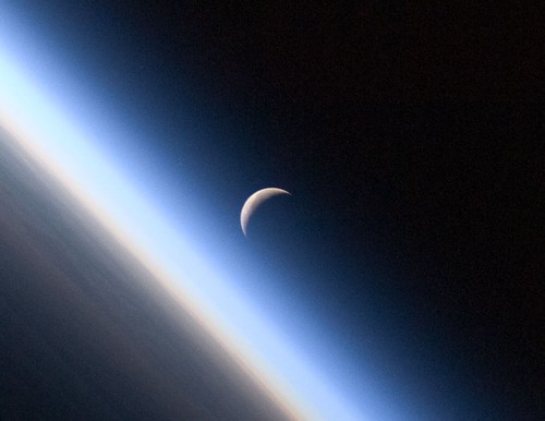
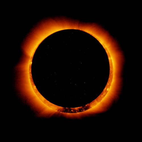
Detail: Crescent Moon, Earth's Atmosphere (NASA, International Space Station Science, 09/04/10) par NASAs Marshall Space Flight Center

Galaxies Collide in the Antennae Galaxies (NASA, Chandra, Hubble, Spitzer, 08/05/10) A beautiful new image of two colliding galaxies has been released by NASAs Great Observatories. The Antennae galaxies, located about 62 million light years from Earth, are shown in this composite image from the Chandra X-ray Observatory (blue), the Hubble Space Telescope (gold), and the Spitzer Space Telescope (red).   The collision, which began more than 100 million years ago and is still occurring, has triggered the formation of millions of stars in clouds of dusts and gas in the galaxies. The most massive of these young stars have already sped through their evolution in a few million years and exploded as supernovas.   The X-ray image from Chandra shows huge clouds of hot, interstellar gas that have been injected with rich deposits of elements from supernova explosions. This enriched gas, which includes elements such as oxygen, iron, magnesium and silicon, will be incorporated into new generations of stars and planets. The bright, point-like sources in the image are produced by material falling onto black holes and neutron stars that are remnants of the massive stars. Some of these black holes may have masses that are almost one hundred times that of the Sun.   The Spitzer data show infrared light from warm dust clouds that have been heated by newborn stars, with the brightest clouds lying in the overlap region between the two galaxies. The Hubble data reveal old stars in red, filaments of dust in brown and star-forming regions in yellow and white. Many of the fainter objects in the optical image are clusters containing thousands of stars.   The Antennae galaxies take their name from the long antenna-like &quot;arms,&quot; seen in wide-angle views of the system. These features were produced by tidal forces generated in the collision.    Read entire caption/view more images: <a href="http://chandra.harvard.edu/photo/2010/antennae/" rel="nofollow">chandra.harvard.edu/photo/2010/antennae/</a>  Image credit: X-ray: NASA/CXC/SAO/J.DePasquale; IR: NASA/JPL-Caltech; Optical: NASA/STScI   Caption credit: Harvard-Smithsonian Center for Astrophysics  Read more about Chandra: <a href="http://www.nasa.gov/chandra" rel="nofollow">www.nasa.gov/chandra</a>  p.s. You can see all of our Chandra photos in the Chandra Group in Flickr at: <a href="http://www.flickr.com/groups/chandranasa/">www.flickr.com/groups/chandranasa/</a>  Wed love to have you as a member!
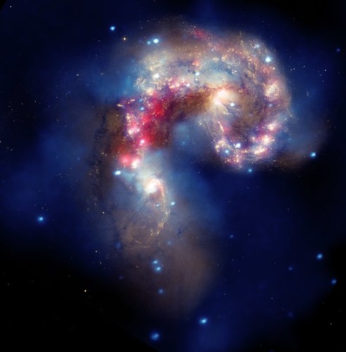
Galaxies Collide in the Antennae Galaxies (NASA, Chandra, Hubble, Spitzer, 08/05/10) par NASAs Marshall Space Flight Center

Lift Off Space shuttle Endeavour and its crew of seven astronauts, including Army Col. Timothy Kopra, lift off on the STS-127 mission to the International Space Station, July 15, from NASAs Kennedy Space Center in Florida.   Read more on Army.mil: <a href="http://www.army.mil/-news/2009/06/11/22472-army-astronaut-heads-for-international-space-station-embraces-social-media-to-share-story/" rel="nofollow">Army astronaut heads for International Space Station, embraces social media to share story</a>
Lift Off par The U.S. Army

Hinode Observes Annular Solar Eclipse January 6, 2010  To see a video of this event go to: <a href="http://www.flickr.com/photos/gsfc/5332593243/">www.flickr.com/photos/gsfc/5332593243/</a>  On January 4, the Hinode satellite captured these breathtaking images of an annular solar eclipse. An annular eclipse occurs when the moon, slightly more distant from Earth than on average, moves directly between Earth and the sun, thus appearing slightly smaller to observers eyes; the effect is a bright ring, or annulus of sunlight, around the silhouette of the moon. Hinode, a Japanese mission in partnership with NASA, NAOJ, STFC, ESA, and NSC, currently in Earth orbit, is studying the Sun to improve our understanding of the mechanisms that power the solar atmosphere and drive solar eruptions.  Hinode, launched in September 2006, uses three advanced optical instruments to further our understanding of the solar atmosphere and turbulent solar eruptions that can impact hardware in orbit and life on Earth.  <b>Image credit: Hinode/XRT</b>  More from NASA: <a href="http://www.nasa.gov/mission_pages/sunearth/news/news20110106-annulareclipse.html" rel="nofollow">www.nasa.gov/mission_pages/sunearth/news/news20110106-ann...</a>  <b><a href="http://www.nasa.gov/centers/goddard/home/index.html" rel="nofollow">NASA Goddard Space Flight Center</a></b> enables NASA’s mission through four scientific endeavors: Earth Science, Heliophysics, Solar System Exploration, and Astrophysics. Goddard plays a leading role in NASA’s accomplishments by contributing compelling scientific knowledge to advance the Agency’s mission.  <b>Follow us on <a href="http://twitter.com/NASA_GoddardPix" rel="nofollow">Twitter</a></b>  <b>Join us on <a href="http://www.facebook.com/pages/Greenbelt-MD/NASA-Goddard/395013845897?ref=tsd" rel="nofollow">Facebook</a></b>
Hinode Observes Annular Solar Eclipse par NASA Goddard Space Flight Center

Space Shuttle Endeavour Over Earth (NASA, International Space Station Science, 02/09/10)  Though astronauts and cosmonauts often encounter striking scenes of Earths limb, this very unique image, part of a series over Earths colorful horizon, has the added feature of a silhouette of the space shuttle Endeavour. The image was photographed by an Expedition 22 crew member prior to STS-130 rendezvous and docking operations with the International Space Station. Docking occurred at 11:06 p.m. (CST) on Feb. 9, 2010. The orbital outpost was at 46.9 south latitude and 80.5 west longitude, over the South Pacific Ocean off the coast of southern Chile with an altitude of 183 nautical miles when the image of the was recorded. The orange layer is the troposphere, where all of the weather and clouds which we typically watch and experience are generated and contained. This orange layer gives way to the whitish Stratosphere and then into the Mesosphere. In some frames the black color is part of a window frame rather than the blackness of space.   Image and caption credit: NASA  Read full caption: <a href="http://spaceflight.nasa.gov/gallery/images/station/crew-22/html/iss022e062673.html" rel="nofollow">spaceflight.nasa.gov/gallery/images/station/crew-22/html/...</a>  More about the Crew Earth Observation experiment aboard the International Space Station: <a href="http://www.nasa.gov/mission_pages/station/science/experiments/CEO.html" rel="nofollow">www.nasa.gov/mission_pages/station/science/experiments/CE...</a>  More about space station science: <a href="http://www.nasa.gov/mission_pages/station/science/index.html" rel="nofollow">www.nasa.gov/mission_pages/station/science/index.html</a>  Theres a Flickr group about Space Station Science. Please feel welcome to join! <a href="http://www.flickr.com/groups/stationscience/">www.flickr.com/groups/stationscience/</a>
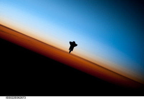
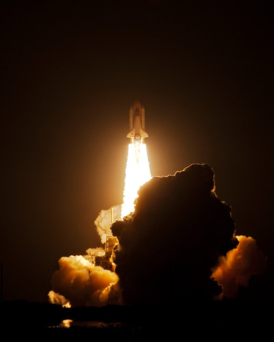
Space Shuttle Endeavour Over Earth (NASA, International Space Station Science, 02/09/10) par NASAs Marshall Space Flight Center

Brasilia, Brazil at Night (NASA, International Space Station, 01/08/11) <i>Editors Note: This is part of a larger Flickr set, &quot;NASA Views Earth at Night,&quot; located here: <a href="http://www.flickr.com/photos/28634332@N05/sets/72157625188331491/">www.flickr.com/photos/28634332@N05/sets/72157625188331491/</a> </i>  Brasilia, Brazil at night time is featured in this image photographed by an Expedition 26 crew member on the International Space Station. Whether seen at night or during the day, the capital city of Brazil is unmistakable from orbit. Brasilia is located on a plateau (the Planalto Central) in the west-central part of the country, and is widely considered to be one of the best examples of 20th century urban planning in the world. One of its most distinctive design features-as seen from above-suggests a bird, butterfly, or airplane traveling along a northwest-southeast direction, and is made dramatically visible by city light patterns (center left, directly to the west of Lake Paranoa). Following the establishment of Brasilia in the early 1960s informal settlements began to form around the original planned city. Ceilandia, located to the west of Brasilia, was one such informal settlement. In 1970 the settlement was formalized by the government and is now a satellite city of Brasilia with its own distinct urban identity. The developed areas of Brasilia and its satellite cities are clearly outlined by street grid and highway light patterns at night in this photograph taken from the space station. The large unlit region to the northwest of the city is the Brasilia National Park (lower left); other dark regions to the south and southwest contain agricultural fields and expanses of Cerrado tropical savanna.   Image credit: NASA   View original image/caption: <a href="http://spaceflight.nasa.gov/gallery/images/station/crew-26/html/iss026e016368.html" rel="nofollow">spaceflight.nasa.gov/gallery/images/station/crew-26/html/...</a>  More about space station research: <a href="http://www.nasa.gov/mission_pages/station/research/index.html" rel="nofollow">www.nasa.gov/mission_pages/station/research/index.html</a>  Theres a Flickr group about Space Station Research. Please feel welcome to join! <a href="http://www.flickr.com/groups/stationscience/">www.flickr.com/groups/stationscience/</a>
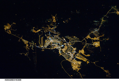
Brasilia, Brazil at Night (NASA, International Space Station, 01/08/11) par NASAs Marshall Space Flight Center

Stunning View of Starburst Galaxy (NASA, Chandra, 04/24/06) [EXPLORED] <i>Editors Note: This is an archive image from 2006.</i>  Images from three of NASAs Great Observatories were combined to create this spectacular, multiwavelength view of the starburst galaxy M82. Optical light from stars (yellow-green/Hubble Space Telescope) shows the disk of a modest-sized, apparently normal galaxy.  Another Hubble observation designed to image 10,000 degree Celsius hydrogen gas (orange) reveals a startlingly different picture of matter blasting out of the galaxy. The Spitzer Space Telescope infrared image (red) shows that cool gas and dust are also being ejected. Chandras X-ray image (blue) reveals gas that has been heated to millions of degrees by the violent outflow. The eruption can be traced back to the central regions of the galaxy where stars are forming at a furious rate, some 10 times faster than in the Milky Way Galaxy.  Many of these newly formed stars are very massive and race through their evolution to explode as supernovas. Vigorous mass loss from these stars before they explode, and the heat generated by the supernovas drive the gas out of the galaxy at millions of miles per hour. It is thought that the expulsion of matter from a galaxy during bursts of star formation is one of the main ways of spreading elements like carbon and oxygen throughout the universe.  The burst of star formation in M82 is thought to have been initiated by shock waves generated in a close encounter with a large nearby galaxy, M81, about 100 million years ago. These shock waves triggered the collapse of giant clouds of dust and gas in M82. In another 100 million years or so, most of the gas and dust will have been used to form stars, or blown out of the galaxy, so the starburst will subside.  Credits: X-ray: NASA/CXC/JHU/D.Strickland; Optical: NASA/ESA/STScI/AURA/The Hubble Heritage Team; IR: NASA/JPL-Caltech/Univ. of AZ/C. Engelbracht  Read entire caption/view more images: <a href="http://chandra.harvard.edu/photo/2006/m82/" rel="nofollow">chandra.harvard.edu/photo/2006/m82/</a>  Caption credit: Harvard-Smithsonian Center for Astrophysics  Read more about Chandra: <a href="http://www.nasa.gov/chandra" rel="nofollow">www.nasa.gov/chandra</a>  p.s. You can see all of our Chandra photos in the Chandra Group in Flickr at: <a href="http://www.flickr.com/groups/chandranasa/">www.flickr.com/groups/chandranasa/</a>  Wed love to have you as a member!
Stunning View of Starburst Galaxy (NASA, Chandra, 04/24/06) [EXPLORED] par NASAs Marshall Space Flight Center

International Space Station (NASA, 02/26/11) <i>Editors note: obviously this isnt an image of Earth, but its a beautiful shot of the International Space Station, which has been providing us with all these beautiful images of our planet. It deserves to take a little bow!</i>  The International Space Station is featured in this image photographed by an STS-133 crew member on space shuttle Discovery as the shuttle approaches the station during rendezvous and docking operations. Docking occurred at 2:14 p.m. (EST) on Feb. 26, 2011. Photo credit: NASA or National Aeronautics and Space Administration   Image credit: NASA   View original image: <a href="http://spaceflight.nasa.gov/gallery/images/station/crew-26/html/s133e006859.html" rel="nofollow">spaceflight.nasa.gov/gallery/images/station/crew-26/html/...</a>  More about space station research: <a href="http://www.nasa.gov/mission_pages/station/research/index.html" rel="nofollow">www.nasa.gov/mission_pages/station/research/index.html</a>  Theres a Flickr group about Space Station Research. Please feel welcome to join! <a href="http://www.flickr.com/groups/stationscience/">www.flickr.com/groups/stationscience/</a>
International Space Station (NASA, 02/26/11) par NASAs Marshall Space Flight Center

STS-130 Night Space Shuttle Launch - Explored Launch of OV-105 Endeavour for space shuttle mission STS-130, the last scheduled night launch of the space shuttle program; Kennedy Space Center, 2010 Feburary 8 04:14:08 EST. Explored Feb. 9, 2010; rank: 6.  <a href="http://bighugelabs.com/onblack.php?id=4344198946&amp;size=large" rel="nofollow">View bigger, on Black</a>  -  Shot using <a href="http://www.flickr.com/photos/shanelin/4358596234/in/photostream/">this lens</a>.
STS-130 Night Space Shuttle Launch - Explored par Shane Lin

Geomagnetic Storm In Progress NASA image captured March 1, 2011  NASA space physicist James Spann sends this picture from Poker Flat, Alaska, where he is attending a scientific conference to study auroras.   A solar wind stream hit Earths magnetic field during the early hours of March 1st. The impact sparked a polar geomagnetic storm that was, at first, minor, but the storm has been intensifying throughout the day. Spotters are now reporting auroras over Northern Ireland, Latvia, Norway, and Sweden. If the trend continues, high-latitude sky watchers will likely witness bright auroras after nightfall on March 1-2. Northern-tier US states such as Maine, Wisconsin, Minnesota, and Washington could be favored with photographic and/or visual displays.   Caption by Dr. Tony Phillips NASAs Goddard Space Flight Center   Photo credit: NASA/GSFC/James Spann  <b><a href="http://www.nasa.gov/centers/goddard/home/index.html" rel="nofollow">NASA Goddard Space Flight Center</a></b> enables NASA’s mission through four scientific endeavors: Earth Science, Heliophysics, Solar System Exploration, and Astrophysics. Goddard plays a leading role in NASA’s accomplishments by contributing compelling scientific knowledge to advance the Agency’s mission.  <b>Follow us on <a href="http://twitter.com/NASA_GoddardPix" rel="nofollow">Twitter</a></b>  <b>Join us on <a href="http://www.facebook.com/pages/Greenbelt-MD/NASA-Goddard/395013845897?ref=tsd" rel="nofollow">Facebook</a></b>
Geomagnetic Storm In Progress par NASA Goddard Space Flight Center

Mediterranean Riviera (NASA, International Space Station Science, 11/04/10) <i>Editors Note: This is part of a small photoset, &quot;NASA Views Earth at Night.&quot; Ill try to keep adding as time permits. <a href="http://www.flickr.com/photos/28634332@N05/sets/72157625188331491/">www.flickr.com/photos/28634332@N05/sets/72157625188331491/</a></i>  From 220 miles above Earth, one of the Expedition 25 crew members aboard the International Space Station aimed a camera through a Cupola window and recorded this night time image of the Mediterranean Riviera and a panorama along the coastline from Valencia, Spain to Livorno, Italy and many points in between including parts of Andorra and Monaco. Islands in the Mediterranean that can easily be delineated in the Nov. 4 picture are the Balearic Islands, as well as Corsica and Sardinia.    Image credit: NASA   View original image/caption: <a href="http://spaceflight.nasa.gov/gallery/images/station/crew-25/html/iss025e011750.html" rel="nofollow">spaceflight.nasa.gov/gallery/images/station/crew-25/html/...</a>  More about space station science: <a href="http://www.nasa.gov/mission_pages/station/science/index.html" rel="nofollow">www.nasa.gov/mission_pages/station/science/index.html</a>  Theres a Flickr group about Space Station Science. Please feel welcome to join! <a href="http://www.flickr.com/groups/stationscience/">www.flickr.com/groups/stationscience/</a>
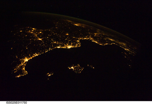
Mediterranean Riviera (NASA, International Space Station Science, 11/04/10) par NASAs Marshall Space Flight Center

International Space Station (NASA, 02/09/10) <i>Editors Note: This image was taken by shuttle Endeavour -- this lovely, illuminated International Space Station is where we get all of the great images from high above the Earth!</i>  Backdropped by Earths horizon and the blackness of space, the International Space Station is featured in this image photographed by an STS-130 crew member as space shuttle Endeavour and the station approach each other during rendezvous and docking activities. Docking occurred at 11:06 p.m. (CST) on Feb. 9, 2010, delivering the Tranquility node and its Cupola.   Image/caption credit: NASA  Read full caption: <a href="http://spaceflight.nasa.gov/gallery/images/station/crew-22/html/s130e006575.html" rel="nofollow">spaceflight.nasa.gov/gallery/images/station/crew-22/html/...</a>  More about the Crew Earth Observation experiment aboard the International Space Station: <a href="http://www.nasa.gov/mission_pages/station/science/experiments/CEO.html" rel="nofollow">www.nasa.gov/mission_pages/station/science/experiments/CE...</a>  More about space station science: <a href="http://www.nasa.gov/mission_pages/station/science/index.html" rel="nofollow">www.nasa.gov/mission_pages/station/science/index.html</a>  Theres a Flickr group about Space Station Science. Please feel welcome to join! <a href="http://www.flickr.com/groups/stationscience/">www.flickr.com/groups/stationscience/</a>
International Space Station (NASA, 02/09/10) par NASAs Marshall Space Flight Center

Activity at Klyuchevskaya Volcano Resumes NASA image acquired December 4, 2010  After a respite of less than a month, Klyuchevskaya Volcano resumed erupting in late November 2010. The Global Volcanism Program reported several ash plumes that rose up to 7.9 kilometers (26,000 feet) above sea level from November 25–29. According to the Kamchatka Volcanic Eruption Response Team (KVERT) seismicity was “slightly above background levels” on November 26th and 27th, and they reported observations of strombolian activity on December 1st and 2nd.  A plume of ash, steam, and other volcanic gases streamed from Klyuchevskaya on December 4, 2010, visible in this natural-color image acquired by the Advanced Land Imager (ALI) aboard the Earth Observing-1 (EO-1) satellite. In the large image, a much smaller plume is visible above neighboring Bezymianny Volcano.  NASA Earth Observatory image by Jesse Allen &amp; Robert Simmon, using ALI data from the NASA EO-1 team. Caption by Robert Simmon.  Instrument:  EO-1 - ALI  Credit: <b><a href="http://www.earthobservatory.nasa.gov/" rel="nofollow"> NASA Earth Observatory</a></b>  <b><a href="http://www.nasa.gov/centers/goddard/home/index.html" rel="nofollow">NASA Goddard Space Flight Center</a></b> enables NASA’s mission through four scientific endeavors: Earth Science, Heliophysics, Solar System Exploration, and Astrophysics. Goddard plays a leading role in NASA’s accomplishments by contributing compelling scientific knowledge to advance the Agency’s mission.  <b>Follow us on <a href="http://twitter.com/NASA_GoddardPix" rel="nofollow">Twitter</a></b>  <b>Join us on <a href="http://www.facebook.com/pages/Greenbelt-MD/NASA-Goddard/395013845897?ref=tsd" rel="nofollow">Facebook</a></b>
Activity at Klyuchevskaya Volcano Resumes par NASA Goddard Space Flight Center

Hubble Captures Spectacular "Landscape" in the Carina Nebula NASA image release April 22, 2010  NASAs Hubble Space Telescope captured this billowing cloud of cold interstellar gas and dust rising from a tempestuous stellar nursery located in the Carina Nebula, 7,500 light-years away in the southern constellation Carina. This pillar of dust and gas serves as an incubator for new stars and is teeming with new star-forming activity. Hot, young stars erode and sculpt the clouds into this fantasy landscape by sending out thick stellar winds and scorching ultraviolet radiation. The low-density regions of the nebula are shredded while the denser parts resist erosion and remain as thick pillars. In the dark, cold interiors of these columns new stars continue to form. In the process of star formation, a disk around the proto-star slowly accretes onto the stars surface. Part of the material is ejected along jets perpendicular to the accretion disk. The jets have speeds of several hundreds of miles per second. As these jets plow into the surround nebula, they create small, glowing patches of nebulosity, called Herbig-Haro (HH) objects.  Long streamers of gas can be seen shooting in opposite directions off the pedestal on the upper right-hand side of the image. Another pair of jets is visible in a peak near the top-center of the image. These jets (known as HH 901 and HH 902, respectively) are common signatures of the births of new stars. This image celebrates the 20th anniversary of Hubbles launch and deployment into an orbit around Earth. Hubbles Wide Field Camera 3 observed the pillar on Feb. 1-2, 2010. The colors in this composite image correspond to the glow of oxygen (blue), hydrogen and nitrogen (green), and sulfur (red). Object Names: HH 901, HH 902 Image Type: Astronomical  Credit: NASA, ESA, and M. Livio and the Hubble 20th Anniversary Team (STScI)  To read learn more about this image go to:  <a href="http://www.nasa.gov/mission_pages/hubble/science/hubble20th-img.html" rel="nofollow">www.nasa.gov/mission_pages/hubble/science/hubble20th-img....</a>  <b><a href="http://www.nasa.gov/centers/goddard/home/index.html" rel="nofollow">NASA Goddard Space Flight Center</a></b>  is home to the nations largest organization of combined scientists, engineers and technologists that build spacecraft, instruments and new technology to study the Earth, the sun, our solar system, and the universe.
Hubble Captures Spectacular "Landscape" in the Carina Nebula par NASA Goddard Space Flight Center

NASA Blue Marble 2007 East <b>RELEASE DATE: OCTOBER 9, 2007</b>  <b>Credit: NASA/Goddard Space Flight Center/Reto Stöckli</b>  A day’s clouds. The shape and texture of the land. The living ocean. City lights as a beacon of human presence across the globe. This amazingly beautiful view of Earth from space is a fusion of science and art, a showcase for the remote-sensing technology that makes such views possible, and a testament to the passion and creativity of the scientists who devote their careers to understanding how land, ocean, and atmosphere—even life itself—interact to generate Earth’s unique (as far as we know!) life-sustaining environment.  Drawing on data from multiple satellite missions (not all collected at the same time), a team of NASA scientists and graphic artists created layers of global data for everything from the land surface, to polar sea ice, to the light reflected by the chlorophyll in the billions of microscopic plants that grow in the ocean. They wrapped these layers around a globe, set it against a black background, and simulated the hazy edge of the Earth’s atmosphere (the limb) that appears in astronaut photography of the Earth.  The land surface layer is based on photo-like surface reflectance observations (reflected sunlight) measured by the Moderate Resolution Imaging Spectroradiometer (MODIS) on NASA’s Terra satellite in July 2004.  The sea ice layer near the poles comes from Terra MODIS observations of daytime sea ice observed between August 28 and September 6, 2001.  The ocean layer is a composite. In shallow water areas, the layer shows surface reflectances observed by Terra MODIS in July 2004. In the open ocean, the photo-like layer is overlaid with observations of the average ocean chlorophyll content for 2004. NASA’s Aqua MODIS collected the chlorophyll data.  The cloud layer shows a single-day snapshot of clouds observed by Terra MODIS across the planet on July 29, 2001. City lights on Earth’s night side are visualized from data collected by the Defense Meteorological Satellite Program mission between 1994–1995.  The topography layer is based on radar data collected by the Space Shuttle Endeavour during an 11-day mission in February of 2000. Topography over Antarctica comes from the Radarsat Antarctic Mapping Project, version 2.  Most of the data layers in this visualization are available as monthly composites as part of NASA’s Blue Marble Next Generation image collection. The images in the collection appear in cylindrical projection (rectangular maps), and they are available at 500-meter resolution. The large images provided above are the full-size versions of these globes. In their hope that these images will inspire people to appreciate the beauty of our home planet and to learn about the Earth system, the developers of these images encourage readers to re-use and re-publish the images freely.  NASA images by Reto Stöckli, based on data from NASA and NOAA.  To learn the history of the Blue Marble go here:  <a href="http://earthobservatory.nasa.gov/Features/BlueMarble/BlueMarble_history.php" rel="nofollow">earthobservatory.nasa.gov/Features/BlueMarble/BlueMarble_...</a>  To learn more about the Blue Marble go here:   <a href="http://earthobservatory.nasa.gov/IOTD/view.php?id=8108" rel="nofollow">earthobservatory.nasa.gov/IOTD/view.php?id=8108</a>  To learn more about NASAs Goddard Space Flight Center go here:  <a href="http://www.nasa.gov/centers/goddard/home/index.html" rel="nofollow">www.nasa.gov/centers/goddard/home/index.html</a>  <b><a href="http://www.nasa.gov/centers/goddard/home/index.html" rel="nofollow">NASA Goddard Space Flight Center</a></b>  is home to the nations largest organization of combined scientists, engineers and technologists that build spacecraft, instruments and new technology to study the Earth, the sun, our solar system, and the universe.   <b><a href="http://www.nasa.gov/centers/goddard/home/index.html" rel="nofollow">NASA Goddard Space Flight Center</a></b>  is home to the nations largest organization of combined scientists, engineers and technologists that build spacecraft, instruments and new technology to study the Earth, the sun, our solar system, and the universe.  <b>Follow us on <a href="http://twitter.com/NASA_GoddardPix" rel="nofollow">Twitter</a></b>  <b>Join us on <a href="http://www.facebook.com/pages/Greenbelt-MD/NASA-Goddard/395013845897?ref=tsd" rel="nofollow">Facebook</a><b> </b></b>
NASA Blue Marble 2007 East par NASA Goddard Space Flight Center

english version

Aucun commentaire:

Enregistrer un commentaire